Tsunamis are among the most powerful and devastating natural phenomena on Earth. These colossal waves, often triggered by underwater disturbances like earthquakes, landslides, or volcanic eruptions, can reshape coastlines, cause destruction, and take lives in a matter of minutes. But perhaps what is most awe-inspiring is the raw force they carry, capable of reaching unimaginable heights. Today, we’ll explore the highest tsunami wave ever recorded, the factors behind such extraordinary events, and how scientists are working to measure and predict them.
What is a Tsunami?
A tsunami is a series of ocean waves caused by large-scale disturbances often generated beneath or near the ocean surface. Unlike regular wind-generated waves, tsunamis carry immense energy that spans the entire water column, from the surface to the seafloor. Their causes include:
- Seismic Activity: Underwater earthquakes are the most common cause, displacing massive volumes of water in seconds.
- Landslides: When sediment or rock slides into a body of water, it can send massive waves rippling outward.
- Volcanic Eruptions or Ice Melt: These relatively rare triggers can result in localized and often destructive tsunamis.
Historical Overview of Tsunami Giants
Throughout history, tsunamis have left a devastating legacy. From the 2004 Indian Ocean tsunami to the Tōhoku tsunami that struck Japan in 2011, people around the world have seen their lives transformed in an instant. However, when it comes to sheer wave height, two tsunamis stand out for their record-breaking extremes.
Lituya Bay, Alaska (1958)
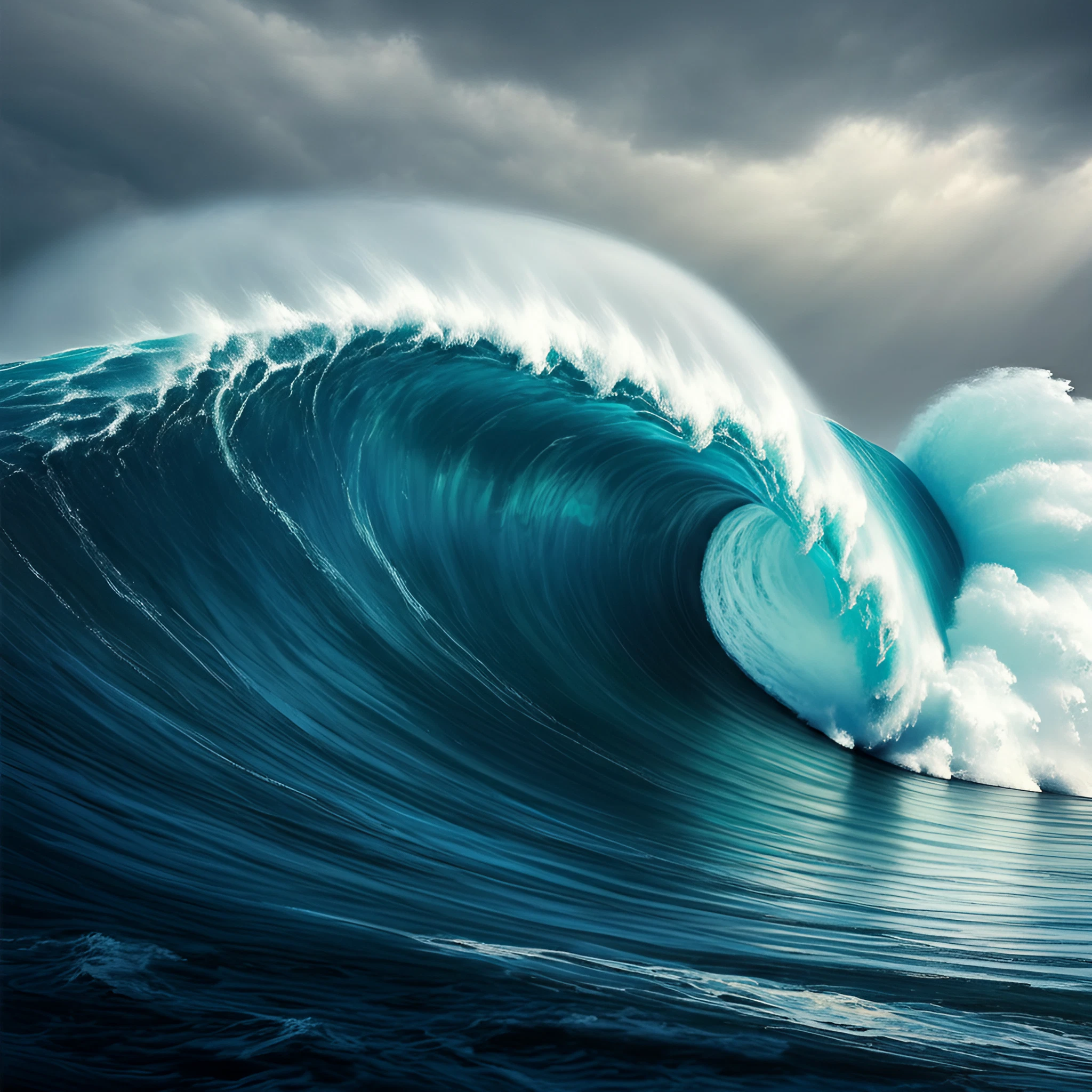
The highest tsunami wave in recorded history occurred in Lituya Bay, Alaska. On July 9, 1958, an earthquake of magnitude 7.8 struck the Fairweather Fault. This triggered a massive rockfall, where approximately 90 million tons of rock crashed into the narrow bay. The result? A staggering tsunami wave that reached a height of 1,720 feet (524 meters), enough to strip vegetation and soil from the mountainsides around the bay.
The wave scoured the landscape, leaving clear marks on the terrain and completely altering the region. Remarkably, there were only two deaths, as Lituya Bay was sparsely populated at the time.
Greenland Fjord (2024)
A more recent megatsunami occurred in Greenland, where a 650-foot tsunami was triggered by the collapse of a glacier, driven by climate change. A landslide displaced massive volumes of water in the Dickson Fjord, sending waves crashing back and forth for nine days in a phenomenon known as a “seiche.” While no lives were lost, the event is a stark reminder of the increasing risks posed by landslide tsunamis in Arctic and subarctic regions.
What Causes Such Record-Breaking Waves?
Extreme wave heights, like those seen in Lituya Bay and Greenland, are the result of several contributing factors:
- Geology and Terrain: Narrow bays or fjords amplify wave energy when water is confined within their walls.
- Force of Impact: The size and speed of the material displacing water, whether rock, ice, or sediment, directly affect the wave height.
- Angle of Entry: Vertical or near-vertical rockfalls, such as in Lituya Bay, create larger and more powerful waves compared to gradual slopes.
- Climate Change: Increased glacial melt and permafrost erosion are destabilizing mountainous regions, making such events more common in Arctic zones.
How Do We Measure Tsunamis?
Scientists rely on advanced tools and methodologies to measure and predict tsunami activity, ensuring communities have the knowledge they need to stay safe.
- Tide Gauges: Installed along coastlines, these instruments record changes in sea level caused by tsunamis.
- Deep-ocean Assessment and Reporting of Tsunamis (DART) systems: These sensors detect water pressure changes deep in the ocean to track tsunami waves traveling across vast distances.
- Seismic Monitors: By detecting earthquake activity near the ocean, these monitors provide early warnings for tsunamis caused by seismic events.
- Satellite Imaging: Advances in satellite technology allow scientists to analyze terrain changes caused by tsunamis, such as the Greenland seiche.
Preparing for Tsunamis
While tsunamis of Lituya Bay’s magnitude are extremely rare, smaller yet highly destructive events are common enough to warrant awareness and preparedness, especially for coastal communities. Here are some key safety tips:
- Know the Warning Signs: Earthquakes, unusual ocean behavior (such as water rapidly receding), and sudden, loud ocean roars are all potential indicators of a tsunami.
- Create an Evacuation Plan: Identify high ground or inland areas where you can move quickly if warned of a tsunami.
- Stay Updated: Pay attention to warnings from weather agencies and local authorities.
- Emergency Kits: Always have an emergency kit with water, food, and medical supplies ready for rapid evacuation.
Why Awareness Matters
Tsunamis are a global hazard that can strike with little warning, yet the right knowledge can save countless lives when disaster strikes. From the mountainous fjords of Greenland to the deep-sea trenches bordering Alaska, the world has much to learn about the extremes of nature. Events like the highest tsunami wave at Lituya Bay showcase the immense power and unpredictability of Earth’s dynamic systems.
By advancing science and raising awareness, we’re not only better equipped to understand these events but also to prepare for them. To ensure preparedness, ongoing research, monitoring efforts, and public education are essential.
Learning from the past and understanding the forces behind these waves will help us face the challenges of the future with greater resilience. Stay informed, stay safe, and never underestimate the boundaries that nature can push.