Introduction
A groundbreaking innovation in satellite technology is set to revolutionize our understanding of rainforests, global carbon storage, and climate science. The European Space Agency’s Biomass satellite, launching this week, will leverage cutting-edge radar technology to ‘weigh’ Earth’s forests. By seeing through clouds and dense canopies, this satellite offers an unprecedented look at how trees interact with and impact our planet.
For the first time, scientists will gain consistent and precise data on how rainforests store carbon dioxide, a critical step in improving climate models, tracking deforestation, and addressing climate change.
Purpose of the Satellite
The 1.5 trillion trees within Earth’s rainforests act as a massive carbon sink, storing carbon dioxide and slowing global warming. However, measuring this storage on a large scale has been nearly impossible with current techniques. The Biomass satellite changes that by using advanced radar to penetrate forest canopies and analyze the trees beneath.
By calculating the amount of woody material in forests, the Biomass satellite can offer insight into how much carbon dioxide is locked away in these ecosystems and how much is released into the atmosphere due to deforestation. This critical data will help scientists refine climate models and develop more accurate predictions for global environmental changes.
Key Features of the Biomass Satellite
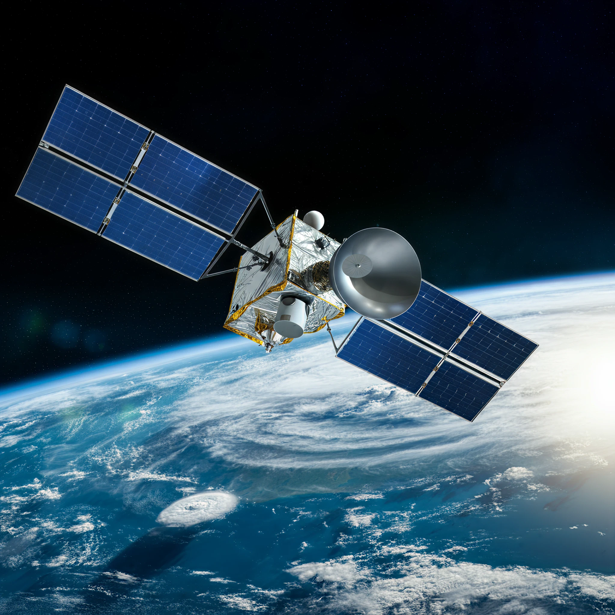
The Biomass satellite combines innovative engineering and technological advancements to accomplish its mission. Its standout feature is its massive 12-meter antenna, affectionately nicknamed the “space brolly.”
- Radar Technology: The satellite uses radar with a very long wavelength capable of penetrating clouds and dense forest canopies. Unlike most radar systems, which only capture images of forest surfaces, this long wavelength can see inside forests, revealing trunks and branches that were previously hidden.
- CT Scan-Like Imaging: The satellite takes multiple passes over the same forests, analyzing layers of trees and building a detailed picture of their structure.
- Lightweight Build: Weighing just 1.2 tons, this groundbreaking piece of technology exemplifies efficient engineering while packing a suite of powerful scientific tools.
Dr. Ralph Cordey, head of geosciences at Airbus, explained the importance of this groundbreaking approach, saying, “By using a much longer radar wavelength, we could see down into the depths of trees and forests.”
Expected Outcomes
The data from the Biomass satellite is expected to significantly impact climate science and conservation efforts.
- Enhanced Climate Models: Current measurements of forest carbon storage are based on small-scale sampling and extrapolation. The satellite will provide consistent, large-scale carbon data, improving the accuracy of climate change forecasts.
- Tracking Deforestation: With annual maps capable of quantifying carbon stored and lost due to deforestation, conservationists and policy-makers will have a new tool to monitor and address global deforestation rates.
- Overcoming Obstacles in Tropical Monitoring: The satellite’s ability to penetrate clouds guarantees consistent observations, even in tropical regions that are frequently obscured by cloud cover.
Initial maps are expected within six months of the satellite’s launch, and data will be gathered for the next five years. These maps will enable year-on-year comparisons and offer a deeper understanding of how forests evolve over time.
Dr. Cordey summarized the excitement surrounding the project, saying, “This is going to tell us about something we perhaps take for granted… how forests contribute to the processes behind climate change, so important to us today and for the future.”
Supporting Quotes
The scientific community has expressed optimism about the Biomass satellite’s potential.
- Prof. Mat Disney, Professor of Remote Sensing at University College London, highlighted the challenges the satellite addresses, stating, “Our current understanding is really patchy because it’s really difficult to measure. Satellites are really the only way you can do that consistently.”
- Dr. Cordey called the project “exciting,” explaining that the satellite provides insights into how trees influence our planet and assist in climate regulation.
Potential Challenges
Despite years of development, the team behind the Biomass satellite acknowledges challenges. The massive 12m antenna must successfully deploy in space. Engineers from L3Harris Technologies, experts in large, deployable systems, collaborated to ensure the antenna operates smoothly after deployment.
If successful, the satellite will open new possibilities for addressing the complex issues of climate monitoring and forest conservation.
Conclusion
The Biomass satellite represents a major leap forward in our ability to understand Earth’s forests and their role in mitigating climate change. By providing consistent, detailed data, it will empower scientists, policy-makers, and conservationists with the tools they need to protect vital ecosystems.
This revolutionary project underscores the potential for space technology to address terrestrial challenges. With its launch, the Biomass satellite offers hope for more informed climate action and a greater appreciation for the role of forests in preserving our planet’s future.